As you can tell from the previous few blog posts, the focus of my time while I was here was more to get out and see the area and all it has to offer, and not so much the city itself. So these photos were taken at various times over the four days that I was here. I’ll start with one of only two glimpses I had of the sun my whole time here - looking out my hotel room window. Despite the rain and fog it was a lovely view!

Sunrise


St. John’s Anglican Church is the oldest church building still in use in Thunder Bay. In 1872, a modest frame church was erected on this site, and in 1884 the present church building was dedicated.


Kwewog Gilwednog - Women of the North - is a large mural that depicts three female figures dressed in regalia, standing along the Potomac (Penegowapcong) River at their pow wow grounds.


The Thunder Bay Museum - located in a historic building (built in 1910) which once served as a Police Station and Court House.


No idea what the plans for this old Canadian Bank of Commerce building are. It was built in 1911 and unfortunately destroyed by fire in 2007.

“Relatives” is one of the last big series Roy Thomas (1949-2004) painted after being diagnosed with cancer. The four colours of “people figures” in the canoe represent our diverse ethnic origins, and our connection to one another through the spirit of life. The butterflies represent the shared spirituality that is all around us. The birds, animals, and fish signify the life givers, “air, land and water”. The canoe symbolized equality amongst all people and that in order to reach our collective goals and aspirations we must work together as one.


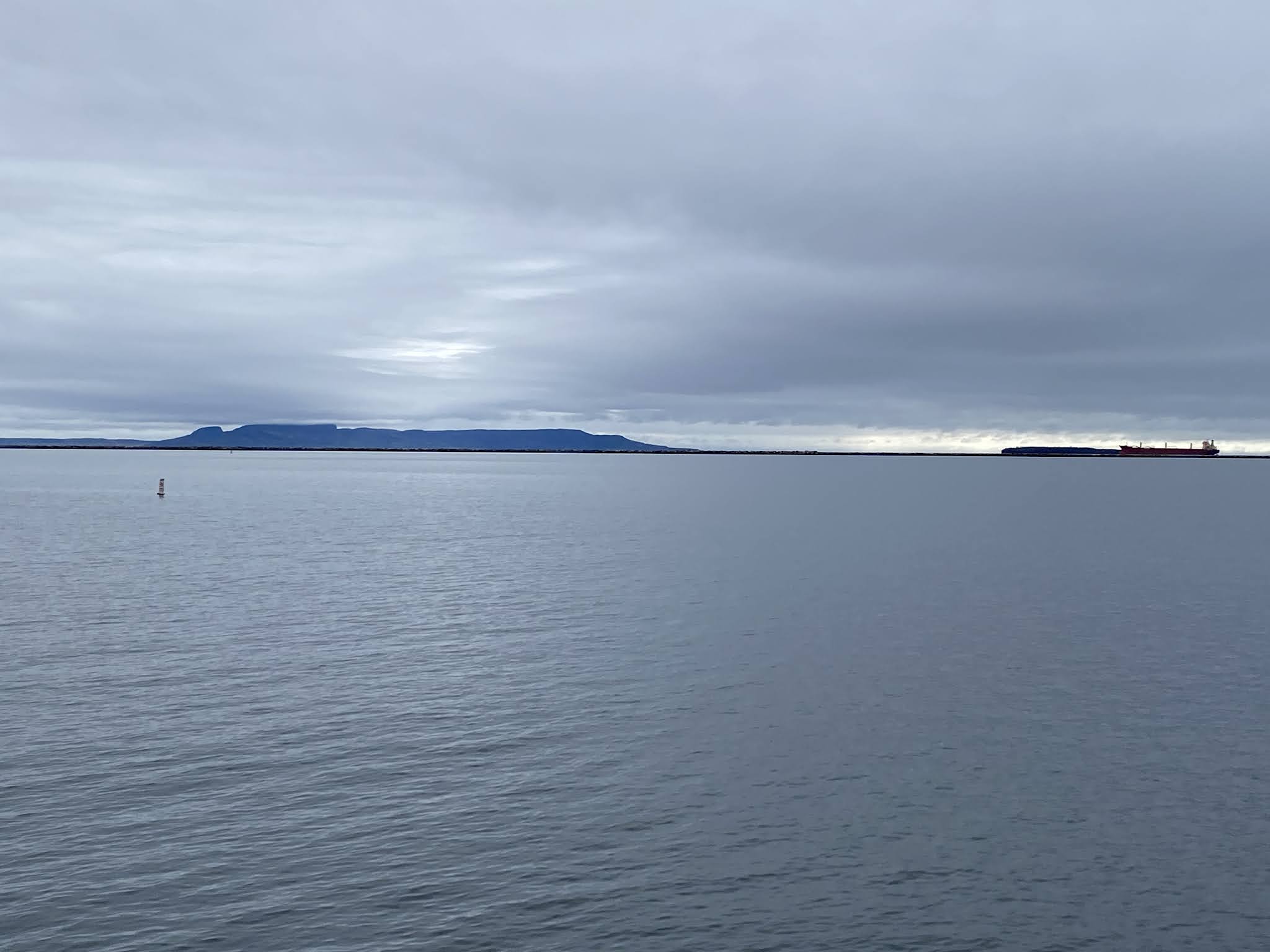
Tanker ships lined up and waiting to come into the port.

Once the largest grain port in the world, the Port of Thunder Bay has a long, storied history and is the western-most entry point for Canadian exports in the St. Lawrence Seaway system. It’s also one of the largest ports from a physical geographic stance, measuring about 35kms in length. The Port of Thunder Bay is currently the largest inland waterway in the world - over 3,700kms from the Atlantic Ocean. To this day, the Port of Thunder Day has the largest grain storage capacity in North America and it is Canada’s second largest grain port behind Vancouver.


The Current River near where it meets Lake Superior. In 1901/1902 a dam was constructed just a bit further up river and the dam resulted in the creation of the Boulevard Lake reservoir.


The Terry Fox Monument is commemorating cancer research activist Terry Fox’s Marathon of Hope. Terry Fox was the courageous runner who, after losing his leg to cancer embarked on the ‘Marathon of Hope’, a cross-country run in support of cancer research. The statue was created to mark the place where Terry Fox was forced to stop his run after 143 day and 5,373 km just outside of Thunder Bay.


Marina Park, or Prince Arthur’s Landing, is a waterfront park and marina. It is the first phase of a 130 million dollar upgrade currently in the works along the waterfront. One thing that I particularly liked is the public art pieces located here.


Celebration Circle Panels - images of animals, representing air, land, water, and fire, are portrayed in the Woodland style of art developed by the Ojibwe people.


2Beacons Jiigew - two 65’ steel beacons with a spoken-word narrative concerning humanity’s interaction with water broadcast from their base. A fusion of art and architecture.


Three cedar lanterns feature vibrant, colourful artwork on their glass-front panels. The digit imagery depicts ‘Giant’ figures and explores the theme of Man’s relationship to the water and to nature.


‘Traveller’s Return’ - stylized, larger than life aluminum water droplets.

‘Embedded History’ - the blended surfaces of this concrete water-feature wall depict textures of wood grains and flowing water, representing the emergence of the Métis people from two distinct cultures.

‘Diatom Whisper - Alchemy’ - this artwork depicts a sample of diatoms taken directly from Lake Superior’s unseen world. Diatoms are water-based microscopic algae that account for a quarter of all the photosynthesis on earth. Tiny alchemists, they take silicon dissolved in water and turn it into intricate glass houses.


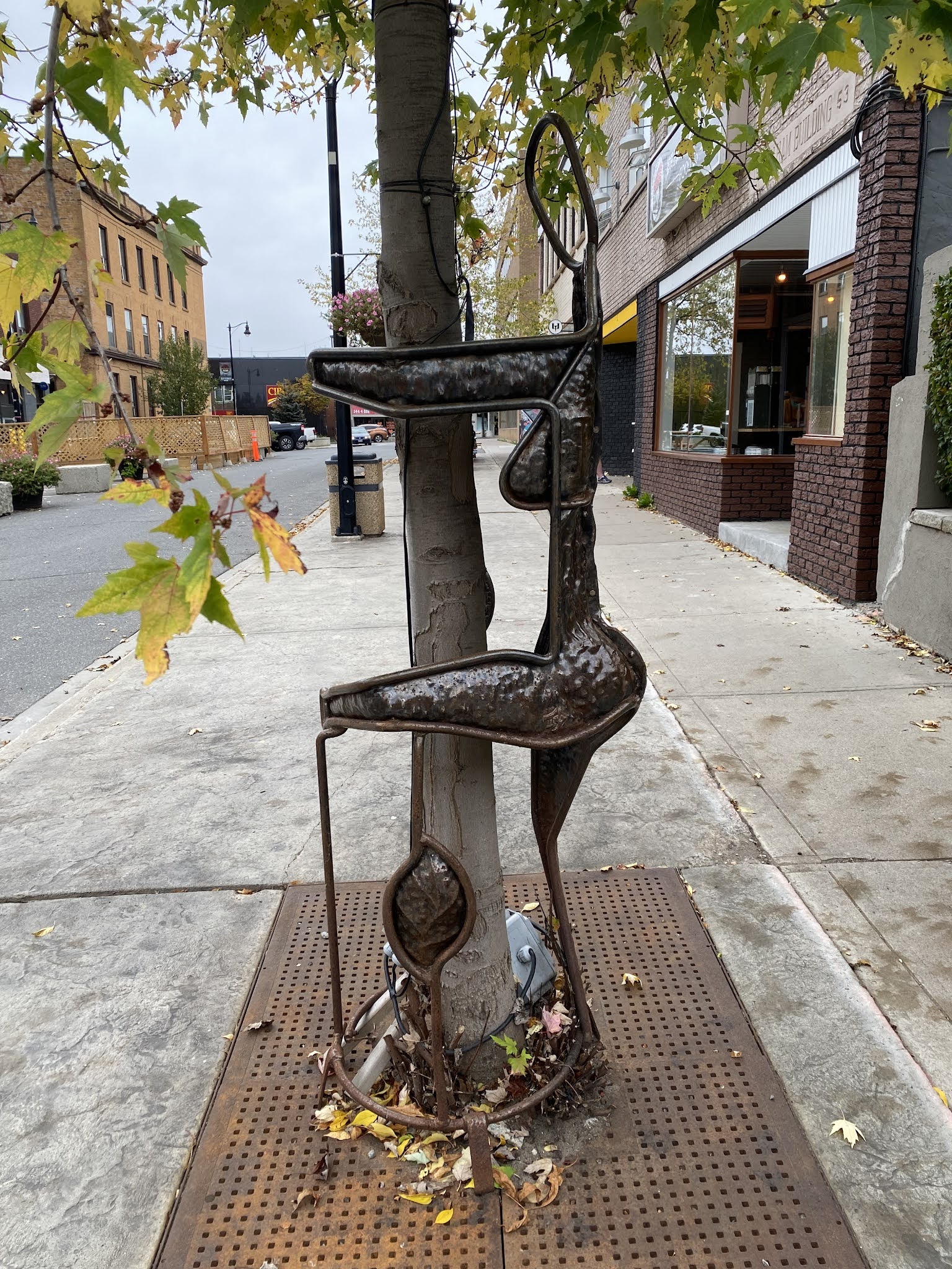
‘Vessel’ - a powerful steel sculpture that also functions as a seating area shows the influence of the waterfront’s history, from voyageurs to the shipbuilding industry.

Built in 1906 by the Canadian Northern Railway, later to become the Canadian National Railway. It received heritage designation in 1979 and is now located within Prince Arthur’s Landing.

The brown building in the centre is the hotel where I was staying…and I was lucky enough to have a room facing the water.


A Thunder Bay original, the Persian is similar to a cinnamon bun but it is richer and the original Persian features distinctive pink icing. Other flavours are also available - in addition to the traditional Persian I also got a blueberry one (in the back).

Thunder Bay’s tourist ‘pagoda’ can rightfully claim its place in history as Canada’s oldest continuously operating tourist bureau. This Chinese-like structure dates back to 1909.

Maybe it’s a ‘northern’ thing…my second “Howe Street” on this trip.

Of course - the day I’m leaving I see the sun again!

The James Street bridge, over the Kaministiquia River, is a historic bridge built in 1909. It’s a railway swing bridge that includes cantilevered lanes for traffic on either side.


The Kaministiquia River

Anemki Wajiw (Mount McKay) is a mafic sill just outside Thunder Bay. It is the highest, most northern and best known of the Nor’Wester Mountains, and a lovely place to go for a lookout over Thunder Bay and surrounding area. It is 299m above Lake Superior and 483m above sea level. It is traditionally known as the “Thunder Mountain” - Animikii-wajiw in Ojibwe and continues to be used for ceremonies.

A memorial commemorating First Nations Peoples that fought in wars.
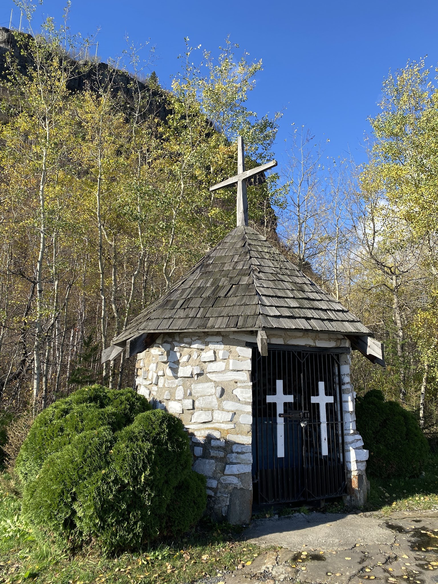
Mountain Chapel - erected in 1888


Ojibwe Elder monument


There is a trail that leads to the very top however it’s very steep and comprised of mostly shale…far beyond my hiking comfort levels and abilities. Fine with me - I was quite happy with the view from the lookouts I could ‘easily’ access.


No comments:
Post a Comment