So lots of time to get lost in your own thoughts while driving this stretch of highway, but also lots of time to see the beautiful scenery:

There is so much water in Labrador, and the highway frequently runs alongside, or crosses over, little lakes and rivers

Seen all along the route, these are storage sheds for snowmobiles

As one expects (?) - a level railway crossing with no lights, bells or gate, across the major (and only) highway in the province


Although not quite as prevalent as on the island of Newfoundland, you do still have to watch out for moose when you're driving here


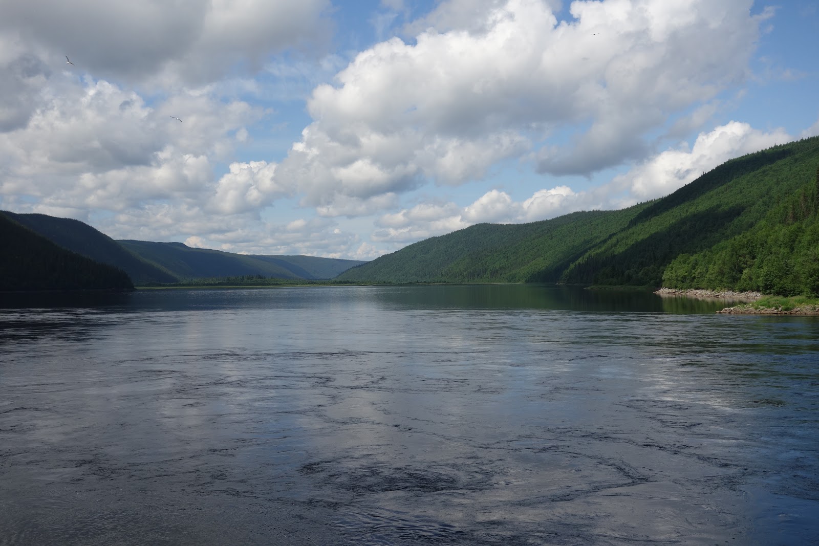
Nearing the end of the journey, that's the Churchill River
Unless you're sleeping in your vehicle, the only place to stop between Labrador City and Happy Valley-Goose Bay is Churchill Falls and I definitely wanted to see and learn more about Churchill Falls so I did overnight there.
The community of Churchill Falls is operated by Nalcor Energy. The employees at the generating station, as well as their families, call this town home and everyone who lives here works for Nalcor. The town's population of approximately 650 residents enjoy living accommodations and recreational facilities. There is also a school, health clinic, church, grocery store, gas station (all owned and operated by Nalcor) and a police detachment.


Houses are only on one side of the street here - the other side is where the snow is plowed to in the winter

Blueberry Lake at Churchill Falls


If you can see in the photos, the green section of the building is the hotel, the brown section has the store, post office, theatre and library, the red section is the school and the blue section is where the athletic facilities are, including a curling rink, gymnasium, fitness centre and pool


Here in the middle of wildness my hotel room was very spacious - with BIG furniture


Look what I found in Churchill Falls
In addition to the town, Churchill Falls is also a waterfall named after former British Prime Minister, Winston Churchill. It is 75m high, located on the Churchill River. Since 1970 the waters of the Churchill River have been diverted into the nearby Churchill Falls hydroelectric power station. The heart of the Churchill Falls Generating Station is the underground powerhouse, or machine hall, a cavern excavated out of solid granite up to 26 metres. The powerhouse is located 310 metres below ground and is 296 metres long, 24 metres wide and 47 metres high from the bottom to the top. The height would be equivalent to a 15-storey building and the powerhouse floor stretches slightly longer than three football fields in length. The Churchill Falls Generating Station is one of the largest underground hydroelectric powerhouses in the world, providing energy to millions of consumers throughout North America, Eleven turbines harness the power of the passive Churchill River, with a generating capacity of 5,428 megawatts.
You are allowed to go underground and tour the generating station, but unfortunately photos are not allowed. They are allowed getting ready for the tour however.


The switchyard


Water is contained by a reservoir created not by a single dam, but by a series of 88 dikes that have a total length of 64 kms. Once all the dikes were in place, it provided a vast storage area which is known as Smallwood Reservoir. The reservoir covers 5700 km2 and provides storage area for more than 1,000,000,000,000 cu ft of water. In a few locations you are drive along the top of the dike.


Looking down to the town of Churchill Falls
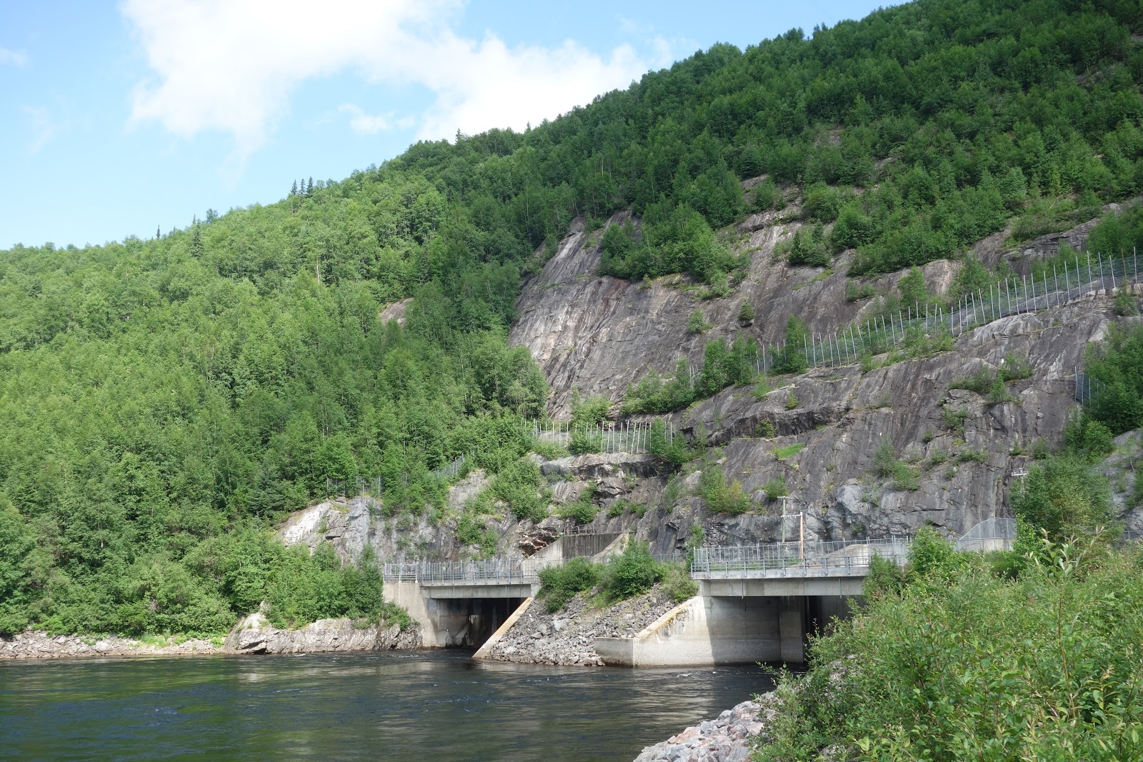
The tailrace from the reservoir back into the mighty Churchill River


I was thinking I might like to go swimming in the Churchill River...got wet to my knees but boy, was it COLD!
No comments:
Post a Comment