Friday morning, miraculously, was blue sky (although still quite cool) and I headed out on a boat cruise of Bonne Bay.

Norris Point, with the Tablelands in the background


The fishing village of Curzon, along the East arm of Bonne Bay

The lighthouse rounding the point into Woody Point

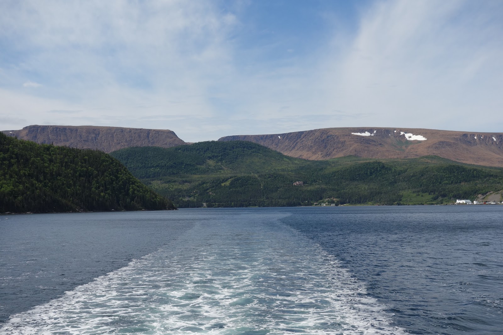
On Bonne Bay, looking out towards the Tablelands


Gros Morne Mountain, as see from Bonne Bay near Norris Point

After the boat cruise it was off for a hike through the Tablelands. Half a billion years in the making - the result of the coming together of two ancient continents - the Tablelands is the Earth’s inner soul: the mantle - exposed in a way that cannot be seen anywhere else.
The Tablelands, found between the towns of Trout River and Woody Point in Gros Morne National Park, look more like a barren desert than traditional Newfoundland. This is due to the ultramafic rock - peridotite - which makes up the Tablelands. It is thought to originate in the Earth’s mantle and was forced up from the depths during a plate collision several hundred million years ago. Peridotite lacks the usual nutrients required to sustain most plant life, hence its barren appearance. The rock is very low in calcium, very high in magnesium, and has toxic amounts of heavy metals. Peridotite is also high in iron, which accounts for its brownish colour (rusted colour), Underneath this weathered zone, the rock is dark green colour.

Main Street, Woody Point, on the way to the Tablelands

Hearty little bell flowers blooming along this very barren looking landscape

The base of the Tablelands

A pitcher plant - the floral emblem of Newfoundland and Labrador. The pitcher plant gets its nourishment from insects that are trapped and drown in a pool of water at the base of its tubular leaves.


Trout River is a small rural fishing village located on the edge of Gros Morne National Park. Trout River was settled in 1815 by George Crocker and his family, who were its only inhabitants until 1880. Today Trout River feels like time stood still there for the approximately 60 families that currently live there - very much a traditional fishing village.


Trout River - a very traditional fishing village

The next morning, before leaving Rocky Harbour and Gros Morne National Park, I took a quick trip out to Lobster Cove Head lighthouse that has marked the marine approach to Rocky Harbour and the entrance to Bonne Bay since 1897. It looks out over the entrance to Bonne Bay from the Gulf of St. Lawrence and is now operated by the Canadian Coast Guard. (As you can see, the sun and the blue skies of the before only lasted that one day.)

The entrance into Bonne Bay from the Gulf of St. Lawrence

Lobster Cove Head Lighthouse

Looking back at Rocky Harbour and the East arm of Bonne Bay
Aren't the Tablelands amazing? I always wish I could take students there in Grade 4, when they're working on rocks and minerals!
ReplyDelete