The Big Apple is a roadside attraction east of Toronto, easily recognizable by its large apple-shaped structure named “Mr. Applehead”, claiming to be the world’s largest. It’s located near Colborne - the village being one of the largest apple producing areas in Ontario. The structure contains apple-based trivia in its interior, an observation deck on its roof, and purportedly can hold 650,000 apples.
Growing European exploration in the 17th century, and the desire for the Europeans to establish a presence close to First Nations peoples to control trade, led to the founding of a French trading post and military fort at a site known as “Cataraqui” in 1673. This outpost became a focus for settlement, and since 1760, the site of Kingston, was in effective British possession.
Kingston was named the first capital of the United Province of Canada in 1841. While its time as a capital city was short (ending in 1844), the community has remained an important military installation. Kingston is also the hometown of John A. Macdonald, Canada’s first Prime Minister.
St. Mary’s Cathedral - construction began in 1842 and it officially opened in 1848.
McIntosh Castle built in 1852.
Frontenac County Court House. This grand building was opened in 1858. It is located on land originally acquired for a house of parliament at a time when Kingston was one of several possible sites for the capital of Canada.
Queen’s University, located in Kingston, is one of Ontario’s oldest universities. The university was founded in 1841 under a royal charter from Queen Victoria and has an enrollment of about 25,000 students. I took a walk through a small part of the campus and saw some beautiful buildings.
Built in 1842 to 1844 this magnificent building is Kingston City Hall. It’s imposing facade faces the waterfront because at the time it was built, visitors to the city usually arrived by ship.
Across the street from the City Hall is the old K&P (Kingston and Pembroke) Railway station. This station was built in 1885 and the K&P Railway brought lumber, iron ore, phosphates, mica and other natural products to Kingston where they were transferred to ships. The Canadian Pacific Railway steam locomotive number 1095, named “Spirit of Sir John A.” was built in 1913 and it sits beside the old railway station. It remembers Sir John A. Macdonald, Canada’s first prime minister who was the Member of Parliament for Kingston and a one-time Kingston alderman.
Confederation Park, across the street from the City Hall, and next to the marina.
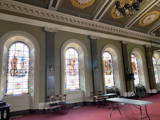
I took a tour of City Hall - it is quite the beautiful building!
Memorial Hall - being renovated right now, but still a very impressive space!
Council Chambers
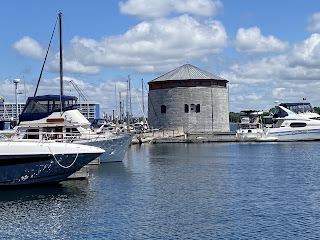
British military engineers designed Shoal Tower and three other Martello towers built between 1846 and 1848 to strengthen the Kingston fortifications, as tensions with the United States threatened to escalate into war. Shoal Tower helped protect the Royal Naval Dockyard, which provided ships for the defense of Lake Ontario and the upper St. Lawrence. It featured massive round walls surrounded entirely by water, making it unique in British North America. Today it is one of the few remaining Martello towers in Canada.
The facade of this hotel, the Prince George, is actually three separate buildings. The middle part is a stone house built about 1817. New stores were built on each side of the house in 1847. The buildings became a hotel in 1848
Grand Trunk (or “inner”) Railway Station was built in 1886. Connecting trains ran from here to the mainline or “Outer” Station that was located on the outskirts of the city.
St. George’s Cathedral was built during the years 1825-1828 and was elevated to cathedral status in 1862.
The Empire Life Insurance Co. building. The building was built in 1853 for the Commercial Bank of the Midland district, sold in 1867 to the Merchants Bank of Canada, and in 1899 it was converted into a High School for boys. Empire Life moved into the building in 1923.
Kingston has a series of walking tours highlighting different areas in the city. I did one which focussed on Earl street, one of the oldest streets in Kingston.
This house was built in 1841 as a boarding house.
The single house on the right was built in 1834. The pair of houses beside it were built in 1844 by Thomas Rogers, the first architect to settle in Kingston.
This frame cottage, sandwiched between two brick houses, is known as “La Salle Cottage” and was built around 1865.
This house was built in the early 1840s. Beginning in 1806 the land was owned by the Roman Catholic bishop and then by the Church itself. This simple dwelling is one of very few surviving “ordinary” stone houses from the period.
This house was built in 1866. Sir John A. Macdonald’s widowed brother-in-law lived in one half for 25 years and Sir John’s unmarried sister, Louisa, also lived here until she died in 1888. While he was a member of Parliament for Kingston, this was Macdonald’s legal residence until 1889.
This two-storey brick house was built in 1888 for John McKay who had a leather and fur business.
“Rosemount” was built in 1849 in the style of a Tuscan villa. The first owner was a Mr. Hardy who owned a dry-goods business.
Built in 1873, these homes have a high basement and three storeys, making them taller than the surrounding houses.
This house was built for the Fraser family in 1847. Mr. Fraser was in the wholesale hardware business and had 10 children.
This house was built in 1848 and the family of John Kerr, then manager of the gas works, lived in it from 1854-1904.
These row houses were built of brick in 1867. They are called “Mozart Terrace” (a terrace is a row of attached houses that look alike).
This house was built in 1886 - note the ‘sunburst’ design on the facade (at the left).
Here I am - in Kingston.
Gord Downie (1964-2017), lead singer and lyricist for The Tragically Hip was born and raised in Kingston.
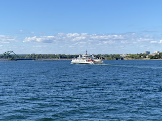
What? Me - back on a ferry again? Of course! This time crossing from the mainland to one of the first islands in the St. Lawrence River … my namesake!
Every time I’m in this area I always think about coming here but never have before today. Howe Island is the second largest of the “Thousand Islands”, measuring about 31 square kilometres. It was originally named Ka-ou-enesegoan by local Iroquois, and later Isle Cauchois after Jacques Cauchois took possession in 1685. In 1792 the island was renamed Howe Island for William Howe, 5th Viscount Howe, who served during the Seven Years War. Howe Island has a shared community of farming as well as cottagers.
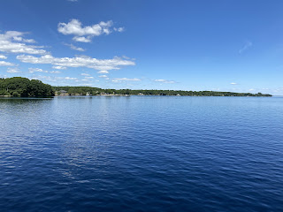
I spent the night at a friend’s place (see post at the end of April about Adolphustown) and in the morning we went for a little walk along the shore of Lake Ontario.
Driving back to Kingston - and you can see all the windmills on Wolfe Island.
The Thousand Islands are a group of more than 1800 islands in the St. Lawrence River, straddling the border between Canada and the USA, where the river emerges from the northeast corner of Lake Ontario. The islands range in size from over 100 square kilometres to smaller islands occupied by a single residence, or uninhabited outcroppings of rocks. To count as one of the Thousand Islands, emergent land within the river channel must have at least one square foot of land above water level year-round, and support at least two living trees.
The region was part of the War of 1812 between the British Empire and the United States and many sites from the war can still be found. In the late 19th and early 20th centuries, many distinguished visitors made the region widely known as a summer retreat. Several grand hotels provided luxurious accommodations while steamboats offered extensive tours among the islands. Wealthy and middle-class summer residents built summer homes, and the region retains a historically important collection of vacation homes from this time.
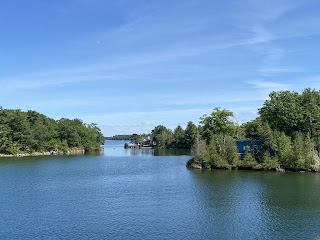
Today my friend and I took cruise through the Thousand Islands … a great way to spend an afternoon!
Nice to have your own helicopter landing pad at your cottage!
Cathcart Tower (1848), on Cedar Island, is another Martello tower, one of four built in the 1840s to protect Kingston’s harbour and the entrance to the Rideau Canal.
Fort Henry with Murney Tower (another Martello tower). Fort Henry was constructed during the War of 1812 to protect the Kingston Royal Naval Dockyard which is the site of the present day Royal Military College of Canada.
And here is the Royal Military College of Canada, with Fort Frederick Tower - the fourth Martello tower.
Back to Kingston’s harbour again, with Shoal Tower.
The next day, leaving that area, waiting for the Glenora Ferry to go across the Bay of Quinte.












No comments:
Post a Comment