Time to head for home now and even though I’m retracing the same route from Thunder Bay to Sault Sté. Marie I wasn’t driving in fog this time and was able to see some/more of the beauty of this drive. I also decided that instead of only taking two days I’m going to take three days / two overnights this time and hopefully the pace of the days will be a bit more relaxed.
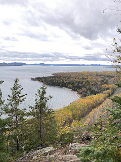
My first stop on my homeward journey was Ouimet Canyon Provincial Park. Ouimet Canyon is a spectacular 150 metre wide by 100 metre deep gorge cut into a diabase sill (a type of very hard igneous rock) near the north shore of Lake Superior. Ouimet Canyon Provincial Park is a Nature Reserve class park which protects rare earth science features and unique arctic-alpine disjunct plant species that thrive in the cold-temperatures present on the floor of the canyon. You would have to travel over 1000kms north, to the shores of Hudson Bay, to find some of the plants that live on the base of Ouimet Canyon. To limit the impact to the flora and fauna, accessing the base of the canyon is not permitted, but there are a couple of trails and viewing pods on the rim which allow you to see just how magnificent it is.
There’s just something about birch trees and boreal forest that is so interesting…almost a bit ‘spooky’ even too!
The Nipigon River is about 48kms long and runs between Lake Nipigon to the north and Lake Superior.
The Nipigon River bridge is a 250 metre long, cable-stayed bridge and is a first of its kind in Ontario.
The Canadian Pacific Railway bridge crossing the Nipigon River, just south of the vehicular/pedestrian bridge.
The Nipigon River
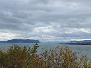
The views from a few pull-over, look-out spots along the highway.
A stop in Rossport along the way.
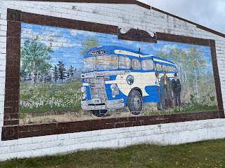
Arriving in Terrace Bay where I’m going to spend the night. This mural was painted in 1997 to celebrate Terrace Bay’s 50th anniversary. It depicts one of the modes of transportation available before the highway was in existence - a trip along a dirt road.
Terrace Bay boasts a beautiful sandy beach along Lake Superior, and a boardwalk for walking that is even lit at night. It was lovely!!
A little backtracking in the morning but not too far - just back to Schreiber.
The Aguasabon Falls - a spectacular 100 ft. waterfall cascades into the Aguasabon Gorge, flowing along a 2.6 billion year old rock face.
The bottom set of rapids in the Aguasabon River, where it meets Lake Superior.
A sand bar created where the Aguasabon River enters Lake Superior. On the left is a very protected area great for kayaking and canoeing, and on the right is the open water of Lake Superior.
A great place to have a picnic but I can tell you, today it would have been impossible to keep your food on the table!
Built in the middle of Terrace Bay as a tourist attraction, this 50 foot lighthouse is based on the one on the Slate Islands which are 13 kms off the coast. You can climb the lighthouse and take in the view.
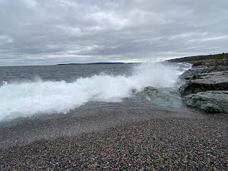
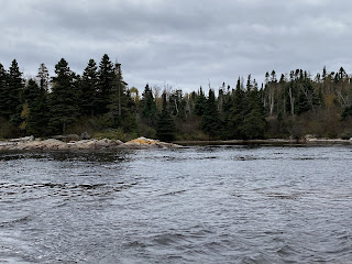
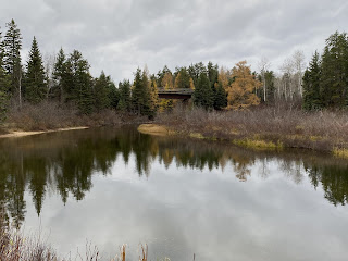
Back on the road again and a few more photos of views along the way.
The Depew River
And then finally arriving in Wawa, just on sunset after a very cloudy day.
In 1960 the section of the Trans-Canada Highway knows as ‘The Gap’, between Agawa and Wawa, was finally completed. A local entrepreneur thought that the town of Wawa would need something to ensure travellers stopped and visited the town (which the new highway bypassed). That’s where the idea of the Wawa Goose Monument began. In Ojibwe, the word “wawa” means “wild goose” or “land of the big goose”. Originally built of plaster and chicken wire, the first Goose Monument was unveiled in 1960 on the same day as the ribbon cutting ceremony for the opening of the final Ontario section of the Trans-Canada Highway.
The first goose monument, made of plaster, struggled to stand up to the elements and so in 1963 a new steel monument was created. The current Goose Monument is the third one to have graced this location - unveiled in 2017. “Wally Goose” is the largest of its kind in Canada…even if Canada Geese are NOT an official symbol of Canada.

















No comments:
Post a Comment