Saturday, 6 August 2016

Second day on Manitoulin Island

Providence Bay is the longest sandy beach on Manitoulin Island.  It's just over a kilometre long, with a lovely boardwalk running alongside it for most of the length.  The mouth of the Mindemoya River is also at Providence Bay - where I saw the otters yesterday.


The boardwalk bridge over the Mindemoya River

First up on the agenda today was going to Wikwemikong Unceded Reserve, located on the eastern end of Manitoulin Island.

The Anishnabek people of Wikwemikong are citizens of the Three Fires Confederacy: an alliance of Odawa, Ojibway and Pottawatomi nations.  The Odawa inhabited Manitoulin Island or “Mnidoo Mnis” for many years prior to any other tribal settlements; and Manitoulin has been referred to as "Odawa Mnis”.  Manitoulin Island has also been called “Ogemah Mnis”, the home of the ancestors as recorded by many chiefs having been buried here.  The Ojibway arrived in Wikwemikong during the 1850s era treaties.  These families continue to reside and contribute to the community. 

In 1832, three Pottawatomi families were already settled in Wikwemikong.  With the ratification of the 1833 Treaty of Chicago in 1835, the U.S. government agents forced the Pottawatomi and neighbouring tribes to sell their land.  More than 3,000 Anishnabek consequently left their homelands.  Pottawatomi families began to arrive in Canada around this time.  Concurrently in 1836, the main objective of the Bond Head Treaty was to initiate the migration of Upper Canada First Nations to Manitoulin Island where they could live free from the influences of the encroaching white civilization.

The Upper Canada First Nations did not migrate to Manitoulin Island as intended.  Therefore, in 1862, the Mcdougall Treaty was initiated and signed.  This treaty targeted the surrender of unsold lands on Manitoulin Island.  Wikwemikong did not sign the treaty and thus it became known as an Unceded Reserve.  In 1968, an amalgamation took place among three bands: Manitoulin Island Reserve, Point Grondine and South Bay.  This amalgamation created the Wikwemikong Unceded Reserve.

The people of Wikwemikong take great pride in the living history, culture and language of their community and in the diverse traditional arts that are present.  In 2006, the citizens of Wikwemikong formally implemented a community-based Anishnaabemowin Language Strategy to retain their language for all future generations.  It was also during this time that the Department of Canadian Heritage designated Wikwemikong as one of several Cultural Capitals of Canada.


Located in Wikwemikong, Holy Cross Mission is the oldest Catholic Church in Northern Ontario. Construction began in 1849 (by Jesuit priests and local First Nations people) and Holy Cross Parish was officially dedicated in 1852.  In 1954 the Church, Hall and residence were destroyed by a fire however the parish records and most of the items were saved by the alertness of some parishioners.  The external walls of what was the residence remain today, and are used in the summer by the De-ba-jen-mu-jig Theatre Group to host theatrical productions.


Nearby, the village of Manitowaning is the first European Settlement on Manitoulin Island - the settlement was established in 1837.  St. Paul's Anglican Church was built in 1845 and is the oldest Anglican Church in Northern Ontario. 


Across from St Paul's Anglican Church is the Manitowaning Lighthouse, built in 1886.


For many years Manitowaning was a major shipping port on Manitoulin Island.  The S.S. Norisle, on display at Heritage Park, was a former cargo and passenger ferry in service from 1946-1974. Manitoulin Roller Mills and Burn's Wharf were built in 1883 and contain some of the original machinery.


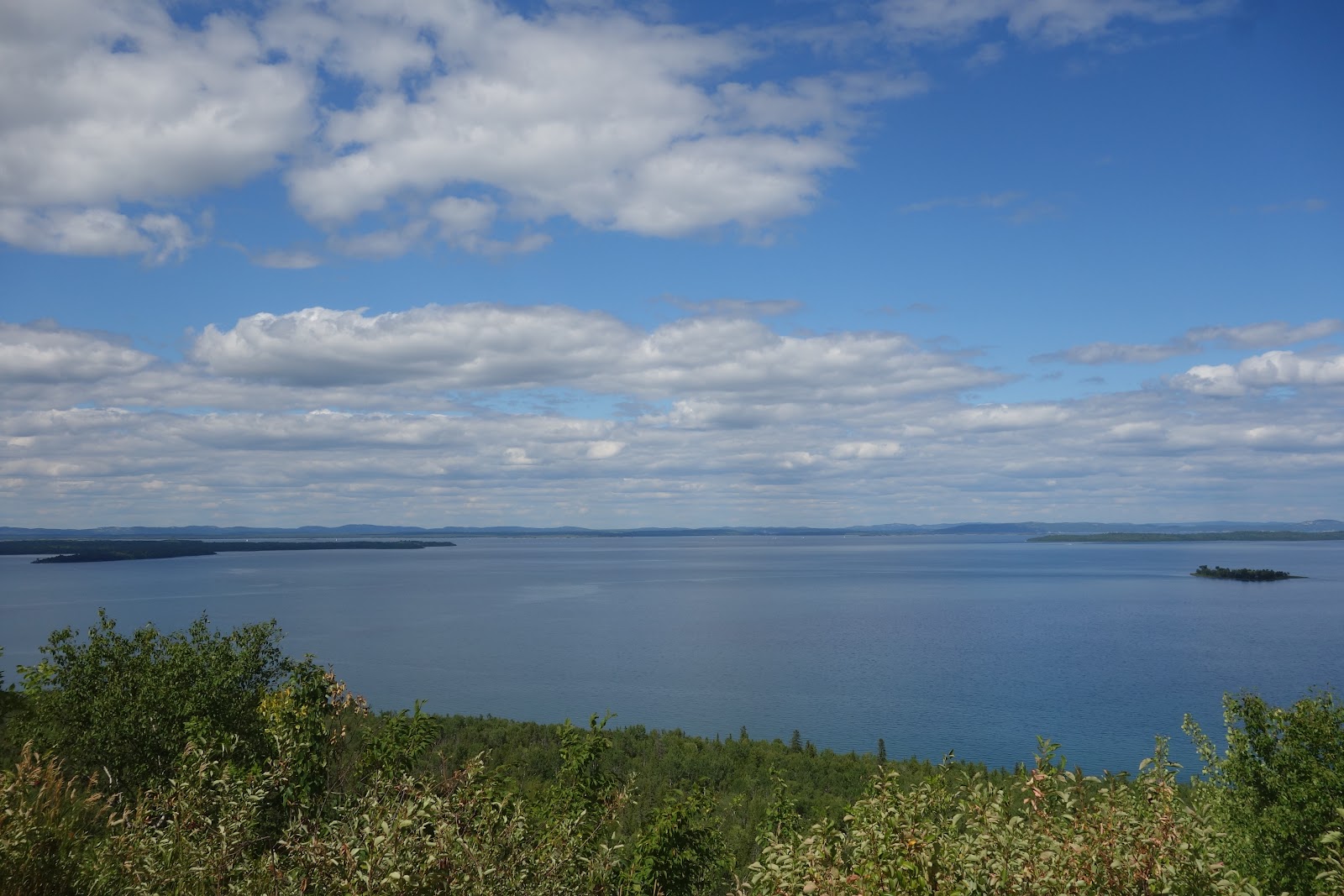
A little further north on the island is the community of Sheguiandah with a beautiful look-out spot overlooking Sheguiandah Bay in the North Channel.


Back to the B&B again - and thought you might like to see the view from the second storey deck that is for guest use.  It was a lovely spot to have coffee in the mornings (and dinner too).

A mural painted on the side of the little local store/art gallery/coffee shop

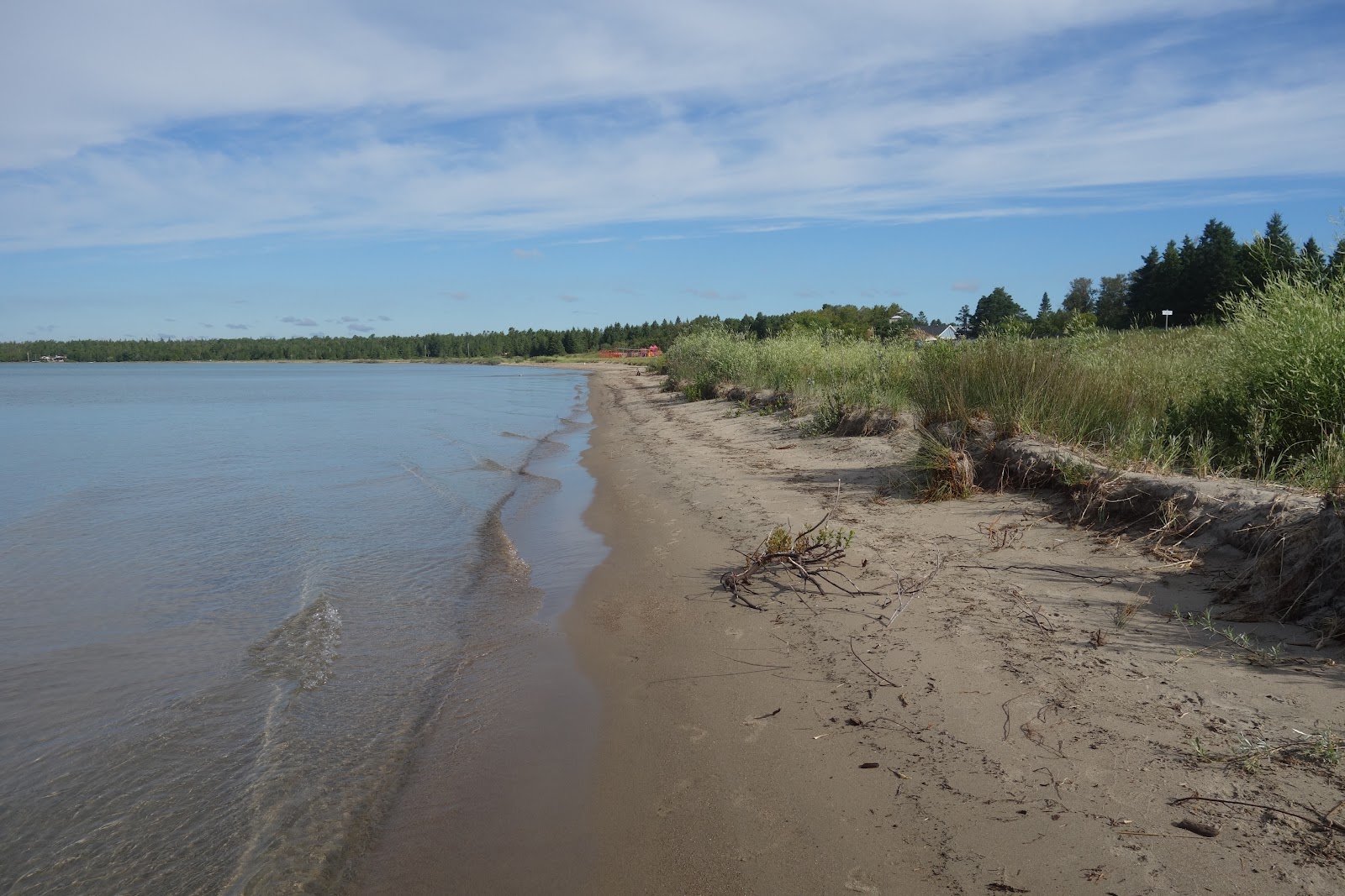
Lake Huron - at Providence Bay

Thursday, 4 August 2016

First day on Manitoulin Island

My first day on Manitoulin Island and I spent it driving a big loop essentially, throughout the middle of the island.  From Providence Bay on the south shore, up to Gore Bay on the north shore, traveling around Lake Mindemoya and Lake Kagawong.

First stop, not far from the B&B, was at a lovely cenotaph, dedicated to the memory of all the men and women from all municipalities and First Nations of Manitoulin who answered the call of their country.


At M'Chigeeng, the Immaculate Conception Church blends First Nations and Catholic religious traditions.  Visitors are welcome in the unusual round building with a conical roof that recalls a traditional teepee.  On the bright blue front door, a yellow sun with four rays in the shape of a cross is a First Nations symbol of Christ.  Inside, other First Nations paintings and carvings decorate the church.


Kagawong was the next stop, a delightful little hamlet located on the shore of Mudge Bay.  Bridal Veil Falls is a waterfall near the town of Kagawong.  The water source is the Kagawong River which flows from Lake Kagawong to Lake Huron.  Bridal Veil Falls has a height of approximately 11m.  


There is a short hiking trail from the falls down to the North Channel (Mudge Bay) with some interesting art works, and little waterfalls in the cliffs, to look at along the way.


At the end of the trail you will find the building that was originally a pulp mill, built in 1925.  The pulp was shipped by freighter to the United States and processed into paper for Sears Roebuck catalogues.


Located next to the old mill is a log building, built in 1890, that served as a general store and post office.


Next stop today was the village of Gore Bay, located on Gore Bay on the North Channel.  Gore Bay has a population of approx. 850 people and is one of the two incorporated towns on the island.  It is also the administrative and government seat for all the communities on Manitoulin Island.  East Bluff Look-out allows for a very scenic look down on both the village and the bay.


Back to Providence Bay at the end of the day - just in time for sunset on the boardwalk.


A Day on the Water - just my kind of day

Today started with a stop at the Bruce Peninsula National Park and a short walk along the Bruce Trail.  The Bruce Trail follows the edge of the Niagara Escarpment and is one of the thirteen UNESCO World Biosphere Reserves in Canada.  The trail is 885 kms long, running from Queeston in the south to Tobermory in the north.


In Bruce Peninsula National Park there is also a viewing tower that affords amazing views out over the National Park and Georgian Bay.  A lot of stairs, but well worth the climb!


After a walk it was time to relax, so out onto Lake Huron and Georgian Bay I went, for a cruise on a glass bottom boat over some of the shipwrecks and out to some of the islands in Fathom Five National Marine Park.

Big Tub Lighthouse stands on the mainland, marking the entrance into Tobermory's natural harbour, Big Tub.  Prior to the lighthouse construction in 1885, Tobermory's first settler, James Earl, hung a lantern atop a pole to guide the schooners into the harbour.


The remains of two vessels, the Sweepstakes and the City of Grand Rapids, are located in the shallow water at the head of Big Tub Harbour.  The wreckage can be seen through the glass bottom of the boat and by looking over the sides.
The Sweepstakes ran aground about 6 kms away from Tobermory in the fall of 1885 and the following spring she was towed to her present location in Big Tub Harbour before she sank.  Her hull is nearly intact with the top deck only 2 metres below the surface.
In 1907 the City of Grand Rapids caught fire while berthed at Little Tub Harbour and in order to prevent the fire from spreading to other vessels and buildings she was towed out of the harbour and released.  The burning hull drifted down into Big Tub, burnt to the waterline and sank.


The next hour (plus) was spent cruising around some of the islands in this area - Russel Island, Cove Island, South and North Islands to name a few of the larger ones.


This is Rock Island (good name for it) with no shortage of bird life - ring-billed and herring gulls and double-crested cormorants.


Flowerpot Island gets its name from two unusual rock formations on its eastern shore. 


 Can you see him - the old man overlooking the lake?


Later in the afternoon it was time to board the Chi-Cheemaun ferry for the two hour trip over to Manitoulin Island.


On the way we passed Cove Island with the Cove Island Lighthouse marking the main shipping entrance into Georgian Bay.  Completed in 1858 it is one of six similar lights known as the Imperial Towers that were built on the Canadian shore of Lake Huron and Georgian Bay.  Cove Island was the last manned lighthouse on Georgian Bay.


Providence Bay, a sleepy little hamlet of about 150 people, on the south shore of Manitoulin Island, is going to be 'home' for the next three days.  Although small, Providence Bay has a lovely boardwalk that runs for about a kilometre along the shore line, and walking along it that first night I saw an otter swimming at the mouth of the Mindemoya River.